Cape Foulwind
Cape Foulwind
West Coast promontory 10 km from Westport: 1876 lighthouse, fur seal colony visible year-round and coastal trail facing the Tasman Sea.
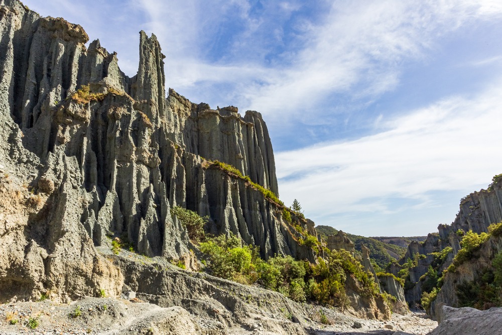
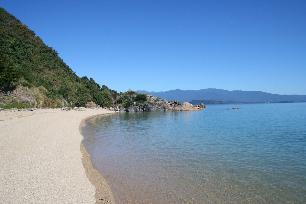
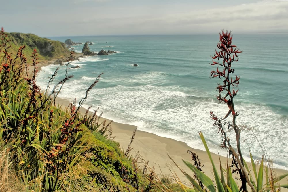
Cape Foulwind is a rocky promontory on the west coast of the South Island, located in the Buller district about ten kilometres west of Westport. The site combines wind-battered cliffs facing the Tasman Sea, a fur seal colony visible year-round, a historic lighthouse and a 3.4 km coastal trail. It sits within a landscape shaped as much by marine wildlife as by the industrial heritage of the West Coast.
Why visit Cape Foulwind
The cape concentrates several points of interest within a small area: marine wildlife observation (fur seals, pelagic birds, occasionally Hector's dolphins), maritime heritage with the lighthouse listed as a historic monument, and sweeping views across the Tasman Sea. Less frequented than flagship West Coast sites like Punakaiki, it suits travellers who favour open coastal landscapes and moderate hiking.
History and origin of the name
Dutch navigator Abel Tasman was the first European to sight the promontory in 1642; he named it Rocky Cape, in reference to the steep nature of the shoreline. In 1770, James Cook, driven offshore by powerful westerly winds as he sailed along the coast, gave it the name Cape Foulwind — literally "cape of bad wind" — which has stuck ever since.
Further out to sea, about 2 km to the north, a cluster of 28 granite islets rising to over 20 metres, the Three Steeples Rocks and the Black Reef, were named "Les Trois Cloches" by Jules Dumont d'Urville in 1827, though they were already known as Black Rocks by 1826.
The cape's recent history is also industrial. A cement plant shaped the local landscape: the project, launched from the 1920s, was realised with the construction of the plant in 1955 by British company Tunnel Portland Cement, operated from 1958 to 2016. A railway line built in 1886 transported rock to the dikes of the Buller River port; vestiges of it are still visible.
What to see on site
The Cape Foulwind lighthouse
Perched about 70 metres above the Tasman Sea, the lighthouse was commissioned on 1 September 1876. The original tower, built from rimu wood (a local timber), quickly deteriorated under harsh weather conditions and was replaced in 1926 by the current concrete structure. The automated LED light is now controlled remotely from Wellington by Maritime New Zealand: it emits a white flash every 12 seconds, visible to about 19 km out to sea. The site is listed as a Category 2 historic monument. The interior of the lighthouse is not open to visitors, but its surroundings are freely accessible; you can observe the foundations of the old lighthouse keepers' houses.
The fur seal colony at Tauranga Bay
At the southern end of the trail, an observation platform overlooks a resident colony of New Zealand fur seals (Arctocephalus forsteri), present year-round. The breeding season, from November to February, is the most active: dominant males return to the rocks and pups are born on site.
Marine wildlife and birds
The offshore waters are home to Hector's dolphins, an endemic and endangered species, orcas, and more rarely southern right whales, whose populations are slowly recovering after the end of commercial whaling. On the bird side, you'll see cormorants, gulls, gannets, shearwaters and blue petrels. Little blue penguins (kororā) nest on Wall Island, an islet visible from the trail.
The Cape Foulwind Walkway
The coastal trail is 3.4 km one way and connects Tauranga Bay to the lighthouse. Allow around 2 hours for the round trip at a leisurely pace with photo stops. The route is linear, not circular: you must return by the same path or arrange a shuttle between the two car parks (north, near the lighthouse; south, at Tauranga Bay). The difficulty is moderate and the trail suits most walkers.
Practical information
- Free access, open year-round.
- Two car parks: north (lighthouse) and south (Tauranga Bay).
- Trail of 3.4 km one way — approximately 2 hours round trip.
- Moderate difficulty; hiking shoes recommended.
- Wind often strong on the promontory: bring a windproof jacket.
- Lighthouse visible from outside only.
Plan at least half a day for the trail and seal observation, and a full day if you wish to include the surrounding area.
When to go
The most favourable period runs from November to February, during the Southern summer: milder conditions, long days, and peak activity in the seal colony (breeding season and births). The rest of the year remains accessible, but wind and showers are more frequent. The West Coast is one of New Zealand's wettest regions: always pack waterproof clothing.
How to get there
The site is located about 10–12 km west of Westport, the main town for services and accommodation. A personal vehicle (rental car or campervan) is strongly recommended: public transport is limited in the area and the cape is off the main routes.
- From Nelson: approximately 3 hours' drive; a bus service also connects the two towns in around 3 hours.
- From Christchurch: approximately 5 hours' drive via the Lewis Pass.
- From Greymouth: approximately 1.5 hours' drive north along the coast.
Nearby attractions
- Westport: stop-over town with services, dining and accommodation.
- Mitchells Gully Gold Mine: former gold mine open to visitors south of the cape, with tunnels inhabited by glowworms — a relic of the West Coast gold rush.
- Three Steeples Rocks and Black Reef: granite islets visible from the coast, 2 km to the north.
- Punakaiki and the Pancake Rocks: about 1 hour's drive south, iconic limestone formations of the West Coast.
To extend your itinerary toward the south of the island, sites such as Kura Tawhiti (Castle Hill) or the Elephant Rocks offer other striking geological landscapes; for lakes and wide open spaces, the Ashburton Lakes complement a South Island route.
FAQ
Frequently asked questions
Yes, particularly if you're travelling along the west coast of the South Island. The site combines an accessible year-round fur seal colony, a historic listed lighthouse and a scenic coastal trail of moderate difficulty, all with free access.
The trail is 3.4 km one way. Allow about 2 hours round trip at a leisurely pace, longer if you take time to observe the seals and seabirds.
No, the lighthouse is not open to the public: it is fully automated and controlled remotely by Maritime New Zealand. Its surroundings remain freely accessible from the trail.
New Zealand fur seals are visible year-round. The most active period runs from November to February, during the breeding season and births.
It's possible but inconvenient. Westport is connected to Nelson by a bus service (around 3 hours), but no regular public transport directly serves the cape from Westport. A rental car, local taxi or organised tour is the better option.
Yes. The trail is wide and well-marked, with moderate difficulty. The seal observation platform on the Tauranga Bay side is reachable within minutes of the south car park, making it suitable for families with young children.
Plan your trip
Cape Foulwind fits naturally into a road trip along the west coast of the South Island, between Nelson, Punakaiki and Greymouth. To build a custom itinerary including the West Coast, consult our New Zealand trips.
Interested in this visit?
We can include it in your personalised itinerary.