Ashburton Lakes
Ashburton Lakes
Thirteen glacial lakes and Ramsar wetlands at the heart of Hakatere Conservation Park, Mid-Canterbury: hiking, mountain biking, fishing and native wildlife.
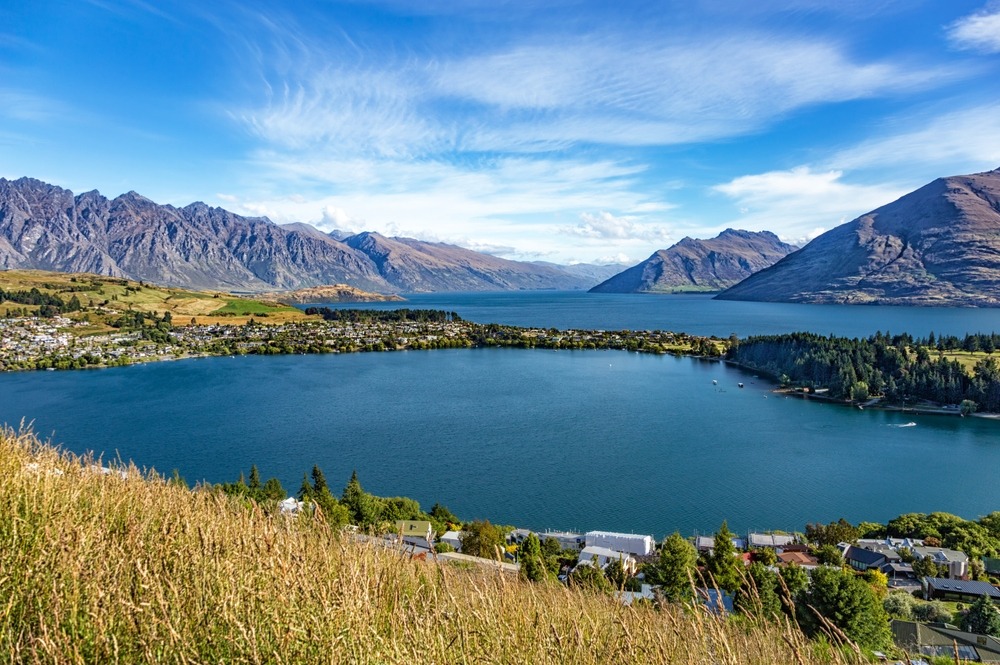
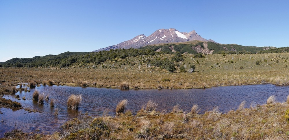
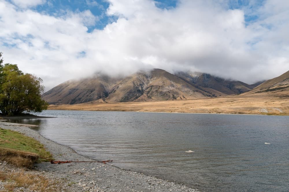
The Ashburton Lakes, or Ō Tū Wharekai in Māori, form a cluster of glacial lakes and wetlands in Mid-Canterbury, on the South Island of Nouvelle-Zélande. This inter-mountainous basin, situated between 700 and 800 metres altitude at the heart of Hakatere Conservation Park (nearly 60,000 hectares), comprises thirteen principal lakes and numerous tarns in a semi-alpine landscape dominated by the Harper and Taylor ranges.
Why visit Ashburton Lakes
The region stands out for three characteristics rarely found in Nouvelle-Zélande: a glacial heritage still legible in the relief, preserved native biodiversity (the zone is designated a Ramsar site) and low tourist pressure. It is one of the last portions of central Canterbury where high-altitude wetlands persist in a state close to their original configuration.
The area attracts primarily hikers, mountain bikers, anglers and birdwatchers. Lovers of alpine landscapes find here an open setting, free from heavy infrastructure, where the Southern Alps are reflected in shallow waters.
Geological history and Māori name
The basin was shaped during the Pleistocene by the combined action of several glaciers, including those of Rakaia, Cameron and Rangitata. At their peak, roughly 28,000 years ago, these glaciers extended as far as the Ashburton Gorge and the Canterbury plains. Retreat towards the valleys began around 15,000 years ago, leaving behind moraine terrain, water-filled depressions and wetlands.
The Māori name Ō Tū Wharekai designates the entire lake system and testifies to the ancient use of the site as a resource zone. The region is today managed as a conservation area by the Department of Conservation and Canterbury's environmental council (ECan).
What to see and do
The principal lakes
The ensemble comprises thirteen principal lakes. Among the most accessible and emblematic:
- Lake Heron — the largest, renowned for salmon fishing
- Lake Clearwater — bordered by a small village of cribs
- Lake Camp — the only lake permitting motorboats
- Lake Emma, Lake Emily, Lake Roundabout
- Maori Lakes, Mystery Lake, Spider Lake
The glacial depressions called kettleholes, scattered throughout the landscape, harbour rare ephemeral vegetation, particularly sensitive to climatic variations.
Hiking
Several trails crisscross the park, from short lake loops to the ascent of Mount Guy (approximately 2 h 30 from the base). A section of the Te Araroa Trail, the national footpath that traverses Nouvelle-Zélande, passes through the area and allows long stages between huts.
Mountain biking
Flat or gently rolling tracks connecting the lakes are suited to mountain biking. Featured itineraries:
- Stour Bridge – Lake Emily: 15 km
- Lake Emma – Lake Camp: 9 km
- Lake Clearwater loop: 10.3 km
- Potts River – Mystery Lake: 9.2 km
- Potts River – Potts Hut: 23 km
- Buicks Bridge – Potts Hut: 29.7 km
- Lake Heron – Double Hutt: 10 km
Water sports and fishing
Kayaking, canoeing, paddleboarding, windsurfing and kitesurfing are permitted on all lakes. Lake Camp is the only body of water open to motorboats, making it the summer hub for water-skiing.
Fishing is open from November to April, under mandatory licence. The lakes are primarily home to brown trout; Lake Heron is also known for salmon.
Birdwatching
The wetlands form a refuge for several threatened species:
- The Australasian crested grebe
- The whio (blue duck)
- The kākāriki, a small endemic parrot
Surveys conducted in 2024 further confirmed the presence of the Canterbury knobbled weevil, an insect listed as critically endangered. ECan regards the sector as one of the last strongholds of central Canterbury's native biodiversity.
Practical information
The zone is designated a Ramsar site: a few rules apply.
- Dogs prohibited
- Motorboats permitted only on Lake Camp
- Camping only at designated sites
- Stay on trails, do not disturb wildlife
- Take all rubbish with you, including recyclables
The village of Lake Clearwater has approximately 180 cribs (local holiday homes) and a free-access camping site operating on a donation basis. Lake water must be boiled before consumption. No mobile network is available once past Mount Somers, the last village offering petrol station, grocery store and telephone coverage.
When to visit
The favourable season extends from October to April, with daytime temperatures between 15 and 27°C and nights between 7 and 14°C. March and April offer softer light and autumn colours on the hillsides. In winter, gravel roads become difficult to navigate without a suitable vehicle and some sections may be closed.
How to get there
The lakes are relatively isolated despite their proximity to Christchurch. Key distances:
- Christchurch: approximately 145 km, 2 hours' drive
- Ashburton: approximately 75 km, 1 hour
- Methven: approximately 65 km
From Mount Somers, follow Ashburton Gorge Road, which extends as Hakatere Potts Road (gravel) to reach Lakes Clearwater, Camp, Emma and Roundabout. For Lake Heron, Lake Emily and the Maori Lakes, take Hakatere Heron Road. It is best to download the route offline before departure and refuel at Mount Somers.
Combine with nearby attractions
Ashburton Lakes fit naturally into a wider Canterbury itinerary. Approximately one and a half hours' drive away, Kura Tawhiti (Castle Hill) offers a spectacular limestone boulder site, amid similarly glaciated landscape. Travellers heading further south will appreciate Elephant Rocks and the spherical boulders of Moeraki, two geological curiosities in Otago.
Frequently asked questions
Frequently asked questions
Not essential in dry conditions: the main roads (Ashburton Gorge Road, Hakatere Potts Road, Hakatere Heron Road) are accessible in a standard car, driving carefully on gravel sections. A vehicle with raised ground clearance or a 4x4 is recommended after heavy rain and in winter.
No. As the zone is designated a Ramsar site, camping is restricted to designated sites. The Lake Clearwater site operates on a donation basis. Dogs are prohibited.
No. Coverage ends at Mount Somers. Download your maps offline and plan for fuel, water and food autonomy.
The fishing season runs from November to April, under mandatory licence. Brown trout are present in most lakes; Lake Heron is renowned for salmon.
Only on Lake Camp. Other lakes are reserved for non-motorised activities (kayaking, canoeing, paddleboarding, windsurfing, kitesurfing).
Plan your visit
Ashburton Lakes fit naturally into a South Island circuit, between Christchurch, the Alps and Mackenzie Country. To build a tailor-made itinerary, consult our Nouvelle-Zélande travel experiences.
Interested in this visit?
We can include it in your personalised itinerary.