Northland
The subtropical peninsula north of Auckland, founding land of the Ngāpuhi Maori, between turquoise bays, thousand-year-old kauri forests and Cape Reinga.
Northland forms the northern tip of the North Island, a narrow peninsula of 285 km stretching from Auckland to Cape Reinga. It was here that the first Maori arrived approximately 700 years ago, and also where the first Europeans settled in the early nineteenth century. This dual significance gives the region its character: founding land of the New Zealand nation, yet remaining on the margins of major tourist flows that concentrate further south, in Rotorua or Queenstown.
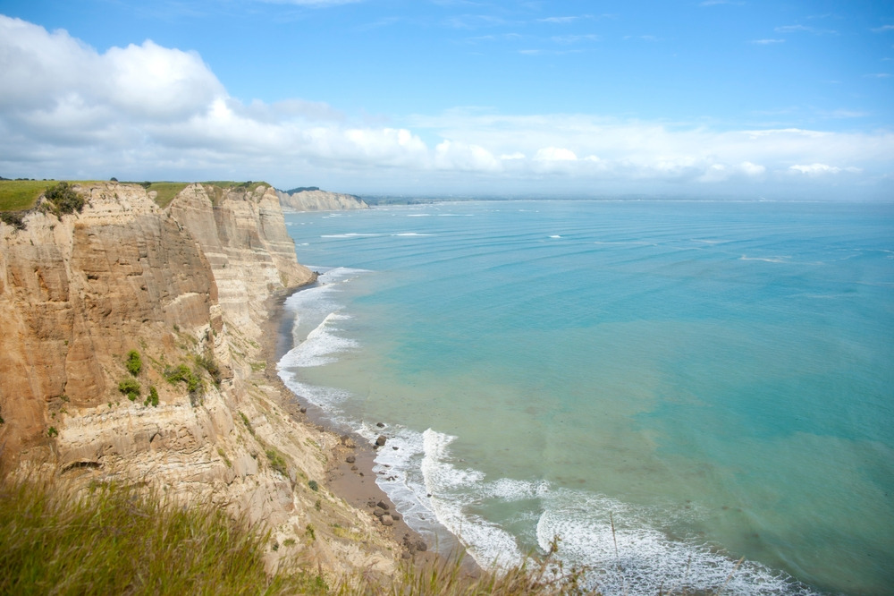
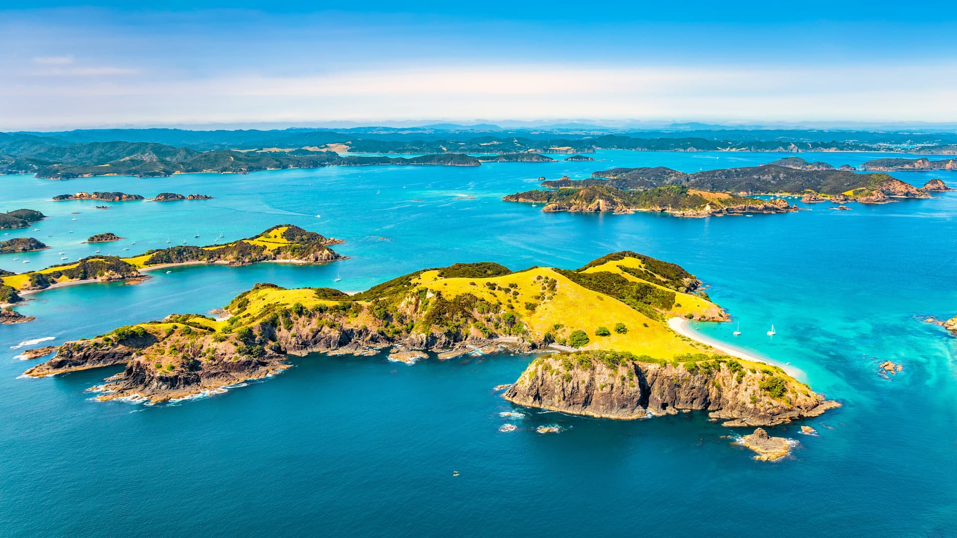
The geography is defined by a few key features. To the east, the coast is carved into sheltered bays, turquoise waters and pink sandstone islets: this is the domain of the Bay of Islands, around Paihia and Russell, and further north Doubtless Bay and Matauri Bay. To the west, the Tasman Sea coast runs straight and windswept, bordered by the unbroken 88 km stretch of Ninety Mile Beach and the giant sand dunes of Te Paki. Between the two, the interior is rolling, covered in dairy pastures and pockets of subtropical forest, the densest of which, Waipoua, shelters the last great kauris—endemic conifers that can reach 50 m in height and are up to 2,000 years old.
The climate is the mildest in the country. Subtropical, with no real winter: 15 °C in July, 25 °C in February, with rainfall distributed throughout the year but more pronounced between June and August. This mildness explains the vegetation—tree ferns, pohutukawas with red flowers in December, mango and avocado trees in Kerikeri's gardens. It also explains the local economy: dairy farming around Dargaville, viticulture around Kerikeri (one of the country's oldest vineyards, planted in 1819), commercial fishing and seaside tourism frequented mainly by Aucklanders on weekends.
Maori presence is strong. Northland has the highest proportion of descendants from the Ngāpuhi iwi (tribes), and several marae (traditional gathering places) welcome visitors accompanied by a guide. Waitangi, 2 km from Paihia, is where the treaty was signed in 1840 between the British Crown and more than 500 Maori chiefs—a founding act still debated today. The site comprises a treaty house, a large ceremonial marae and a 35 m waka taua, a carved war canoe launched each 6 February for the national holiday. Half a day is enough to grasp the stakes, especially with a Maori guide whom we can arrange on request.
Cape Reinga, 220 km north of Paihia, closes off the peninsula. It is a spiritual place for Maori: according to their tradition, the souls of the deceased leave the earthly world here to rejoin Hawaiki, the ancestral homeland, by sliding along the roots of an 800-year-old pohutukawa clinging to the cliff face. On site, you also see the visible collision of currents between the Pacific Ocean and the Tasman Sea, a line of foam marking the meeting of two bodies of water. The white 1941 lighthouse indicates 18,800 km to the South Pole.
Northland is a region to be approached without rushing. Distances are short but winding roads slow the journeys: allow 3h30 from Auckland to Paihia, 4 hours from Paihia to Cape Reinga. It is a land of boats, forest walks, one-shop coastal villages, and stories—those of the Ngāpuhi and those of the first British missionaries who settled in Kerikeri in 1819.
To discover
Boating in the Bay of Islands. A full-day excursion from Paihia among the 144 islands of the gulf, passage through the Hole in the Rock at Piercy Island and spotting common dolphins, present year-round.
Tāne Mahuta in Waipoua Forest. Guided night walk led by a member of the Te Roroa iwi at the foot of the tallest living kauri, 51 m high and 13.8 m in circumference, accompanied by traditional karakia.
Cape Reinga and Te Paki dunes. 4x4 drive along Ninety Mile Beach then sledding down the 100 m sand dunes of Te Paki, before the northernmost point and the meeting of two oceans.
Waitangi Treaty Grounds. Visit to the 1840 treaty signing site, with haka demonstrations on the marae and presentation of the waka taua, a 35 m carved war canoe.
Russell, former whaling port. Ferry crossing from Paihia to Russell, the country's first capital in 1840, its nineteenth-century wooden houses and Christ Church pockmarked by bullets from the 1845 wars.
When to go
Our recommended window extends from November to April. Sea temperatures reach 20 to 22 °C, making swimming and diving at Poor Knights Islands comfortable. December marks the red flowering of pohutukawas along the coasts, and February remains the warmest month (25 to 27 °C during the day). March and April offer a good compromise: the sea is still warm, crowds thin after the New Zealand summer peak from late December to mid-January, when Paihia and Russell fill with local holidaymakers.
June to August are the wettest months: 150 to 180 mm of monthly rainfall on the west coast, days around 15 °C, sea at 16 °C. This is not a season to avoid altogether—kauri forests are stunning in fine rain and accommodations offer low rates—but sea outings are frequently cancelled and Waipoua trails can be muddy. September and October are transitional, with changeable skies, temperatures around 18 °C, and few crowds.
Practical advice
We recommend 4 to 5 days on the ground to cover the region well: 2 days in the Bay of Islands (boating, Waitangi, Russell), 1 day for Cape Reinga and Ninety Mile Beach, 1 day for Waipoua Forest and the west coast, in a loop. The logical entry point is Auckland, 3h30 drive from Paihia via State Highway 1. A domestic flight Auckland-Kerikeri (45 min) is possible but limits circuit flexibility. We organise transfers by chauffeur-driven car or simple rental depending on travel style.
Northland combines naturally at the beginning or end of a North Island exploration. The logical next step is the Volcanic Plateau (Rotorua, Tongariro) then Wellington and Wairarapa before crossing to the South Island. For travellers prioritising the Southern Alps, West Coast or Fiordland, Northland remains relevant but requires planning at least 18 days across the country. This is a region suited to contemplative travellers, families with children (calm beaches, dolphin outings) and those interested in Maori and colonial history. Walkers seeking major high-altitude trails will find more to their taste further south.