Kahurangi National Park
Kahurangi National Park
New Zealand's second-largest national park, Kahurangi combines limestone plateaus, beech forests and the wild Tasman coast. The Heaphy Track, one of the country's Great Walks, is its signature itinerary.
Kahurangi National Park occupies the north-western corner of New Zealand's South Island. The country's second-largest national park, it protects a wild territory of over 450,000 hectares: karst plateaus, beech forests, trout-filled rivers and plant biodiversity among the richest in the Southern Hemisphere. The Heaphy Track, one of New Zealand's Great Walks, forms its backbone.
Quick facts
- Access: main entrances from Collingwood (north) and Karamea (west coast) for the Heaphy Track; from Nelson or Motueka for the eastern sectors.
- Entry: park access is free; booking and fees are mandatory for Heaphy Track huts (via DOC).
- Recommended duration: 4 to 6 days for the full Heaphy Track; one day is sufficient for short walks from the entrances.
- Gear: waterproof hiking equipment essential, weather conditions change year-round.
- Accessibility: very limited; terrain is mostly rugged and unimproved.
What to see
The park brings together radically different landscapes within tens of kilometres. The marble and limestone plateaus of the Takaka Hill sector harbour caves, sinkholes and springs. Further west, the coastal forest gives way to shingle beaches battered by the Tasman Sea. Wildlife includes weka, kiwi, kākāpō (in protected areas) and numerous endemic bird species.
History and context
The name Kahurangi means "precious blue sky" in Māori. The territory was traversed by Māori who used tracks to cross the South Island in search of pounamu (greenstone). The national park was officially established in 1996, consolidating several pre-existing forest reserves. The Heaphy Track follows in part these ancient portage routes.
Highlights of a visit
The Heaphy Track
This Great Walk connects Golden Bay to the west coast at Karamea over approximately 82 km. It successively traverses beech forest, tussock plains of the high plateaus and nikau palm coastal forest — a rare succession of biomes on a single itinerary.
The caves and karst of Takaka Hill
The limestone sector contains extensive underground networks. Waikoropupū Springs (Te Waihou), one of the world's clearest freshwater springs, lies on the park's periphery near Takaka.
The Tasman coast
The final stretch of the Heaphy runs alongside cliffs and isolated beaches. In summer, dolphins are regularly sighted from the trail. It's one of the rare Great Walks with direct ocean views.
Short walks from the entrances
For those not tackling the full trek, half-day loops depart from Brown Hut (Collingwood side) or Kohaihai (Karamea side) and provide a taste of the coastal forest without a multi-day commitment.
Photography tips
Golden light in late afternoon illuminates nikau palms on the west coast. Tussock plateaus offer clear skies ideal for landscape photography at midday. Inside the forest, overcast days reduce contrast and reveal vegetation detail better. Wildlife shots (weka, birds) are easiest early morning near the huts.
Location and access
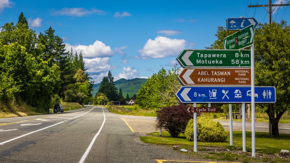
The park spans the Tasman and Buller districts in the north-west of the South Island. The north-eastern entrance is accessible from Nelson (approximately 2 hours' drive) or Motueka. The northern entrance (Collingwood) is reached from Takaka in Golden Bay. The south-western entrance (Karamea) is isolated and requires travelling the west coast from Westport. No regular public transport serves the park entrances; seasonal shuttles operate for Heaphy Track trampers (booking recommended). No road crosses the park.
Nearby attractions
- Abel Tasman National Park — neighbouring to the east, famous for its golden granite beaches and coastal track accessible by kayak.
- Nelson — nearest city, logistics hub with art galleries and artisan market.
- Golden Bay — isolated bay to the north, gateway to Farewell Spit and Wharariki beaches.
- Farewell Spit — 35 km sand bar, nature reserve at the north tip of the South Island.
Frequently asked questions
Yes. Heaphy Track huts and campsites are managed by the Department of Conservation (DOC) and require paid booking, especially during peak season (October-April). Spaces are limited.
Southern summer (December-February) offers the most stable conditions. Spring (October-November) and autumn (March-April) are also viable with fewer crowds. Winter is possible but huts are less heated and rivers may be in flood.
Yes, the Heaphy Track is one of the rare Great Walks open to mountain bikes, but only outside the peak tramping season (generally May to November). Check exact dates with DOC before planning.
Yes. Short walks depart from Brown Hut (north) and Kohaihai (south-west) entrances. They allow you to explore the coastal forest or the opening sections of the Heaphy without a night in a hut.
Main risks are sudden river floods and rapid weather changes. Consult DOC weather bulletins before departing and heed safety advice posted at entrances.
Both parks are accessible from Nelson or Motueka. One week allows you to walk the Heaphy Track then reach Abel Tasman for its coastal track or a kayaking excursion. A shuttle or rental car is needed between the two entrances.
Interested in this visit?
We can include it in your personalised itinerary.