Mount Ngauruhoe
Mount Ngauruhoe
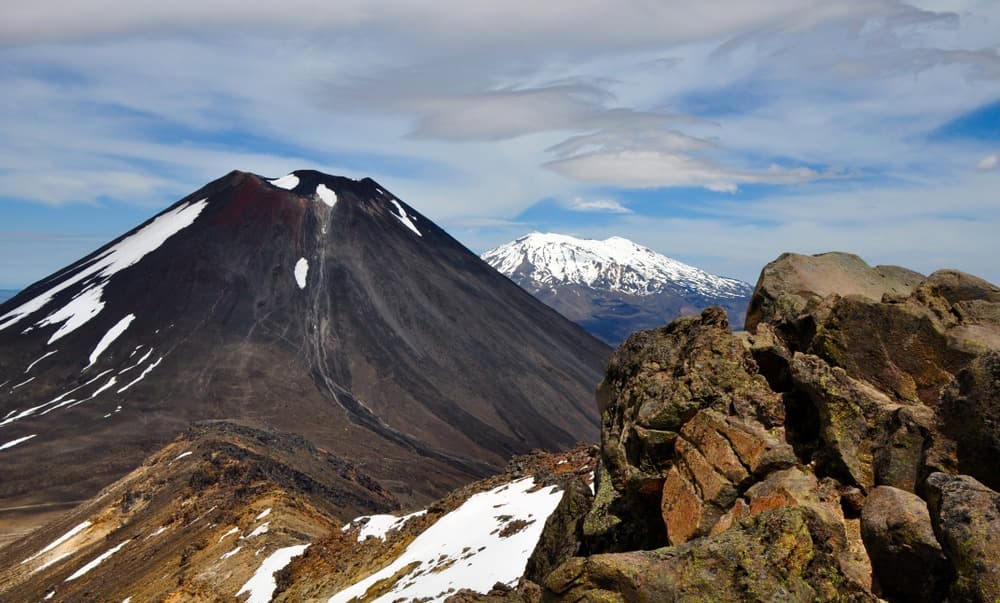
A conical stratovolcano rising 2,291 m in Tongariro National Park, Mount Ngauruhoe is sacred to the Maori people and served as the model for Mount Doom in The Lord of the Rings.
Mount Ngauruhoe is a conical stratovolcano located in the heart of New Zealand's North Island, within Tongariro National Park, a UNESCO World Heritage site. It rises to 2,291 metres and towers approximately 900 metres above the south slopes of Mount Tongariro, roughly 25 km south of Lake Taupo. Sacred to the Maori people and recognised worldwide as the model for Mount Doom in The Lord of the Rings film trilogy, it remains one of the country's most active volcanoes.
Why visit Mount Ngauruhoe
Mount Ngauruhoe combines several rare attractions in a single location. Its near-perfect conical silhouette makes it one of New Zealand's most photogenic stratovolcanoes. It sits within an active volcanic landscape where craters, emerald lakes, lava flows and fumaroles alternate. Its status as a sacred site (tapu) for the iwi Ngāti Tūwharetoa endows it with strong cultural significance, further enhanced by its global cinematic fame.
For the vast majority of visitors, the approach is via the Tongariro Alpine Crossing, widely considered one of the world's finest single-day hikes, which skirts the volcano without reaching its summit.
Geological history and volcanic activity
Mount Ngauruhoe owes its existence to the subduction of the Pacific Plate beneath the Australian Plate, which gave rise to the Taupo volcanic zone. Geologically, it represents the youngest eruptive vent of the Mount Tongariro volcanic complex, formed between 2,500 and 7,000 years ago. A stratovolcano composed of layers of andesitic lava, cinders and ash, its symmetrical shape results from the successive accumulation of these materials.
Since 1839, over 70 eruptions have been recorded. The 20th century proved particularly active, with 45 eruptions, notably between 1945 and 1975: ash explosions, volcanic plumes rising to 13 km altitude and projections of incandescent material. The last confirmed eruption occurred on 4 July 1977.
Since then, the volcano has remained quiet but is under continuous monitoring. Fumaroles remain visible on the eastern and northern crater edges, and peaks of seismic activity were recorded in 2006 and 2015, leading to temporary elevation of the volcanic alert level to 1 (on a scale of 0 to 5).
The mountain in Maori tradition
For the iwi Ngāti Tūwharetoa, Mount Ngauruhoe is a living entity endowed with mana. According to legend, it was named by the great priest Ngātoro-i-rangi: caught in a violent snowstorm during his ascent, he invoked sacred fire from Hawaiki. This fire travelled beneath the earth's crust, emerging successively at White Island, in Rotorua and in the Taupo region, before bursting forth at his feet.
Several interpretations of the name "Ngauruhoe" coexist: it may evoke a slave who died of cold, the insertions of the sacred staff into the ground, or the hurling of burning stones during eruptions. Today, the summit is considered tapu (sacred): the Department of Conservation removed trail markers leading to it, and ascent is strongly discouraged out of respect for Maori beliefs.
Mount Doom from The Lord of the Rings
Mount Ngauruhoe served as the model for Mount Doom (the Mountain of Fate) in Peter Jackson's trilogy. Its conical silhouette proved ideal for depicting the mountain where Frodo must cast the One Ring. Out of respect for Maori culture, however, the summit was not filmed in close-up: scenes were shot from a distance and then digitally retouched. The dark slopes and surrounding lava fields appear in several key sequences of The Return of the King.
What to see and do around the volcano
The Tongariro Alpine Crossing
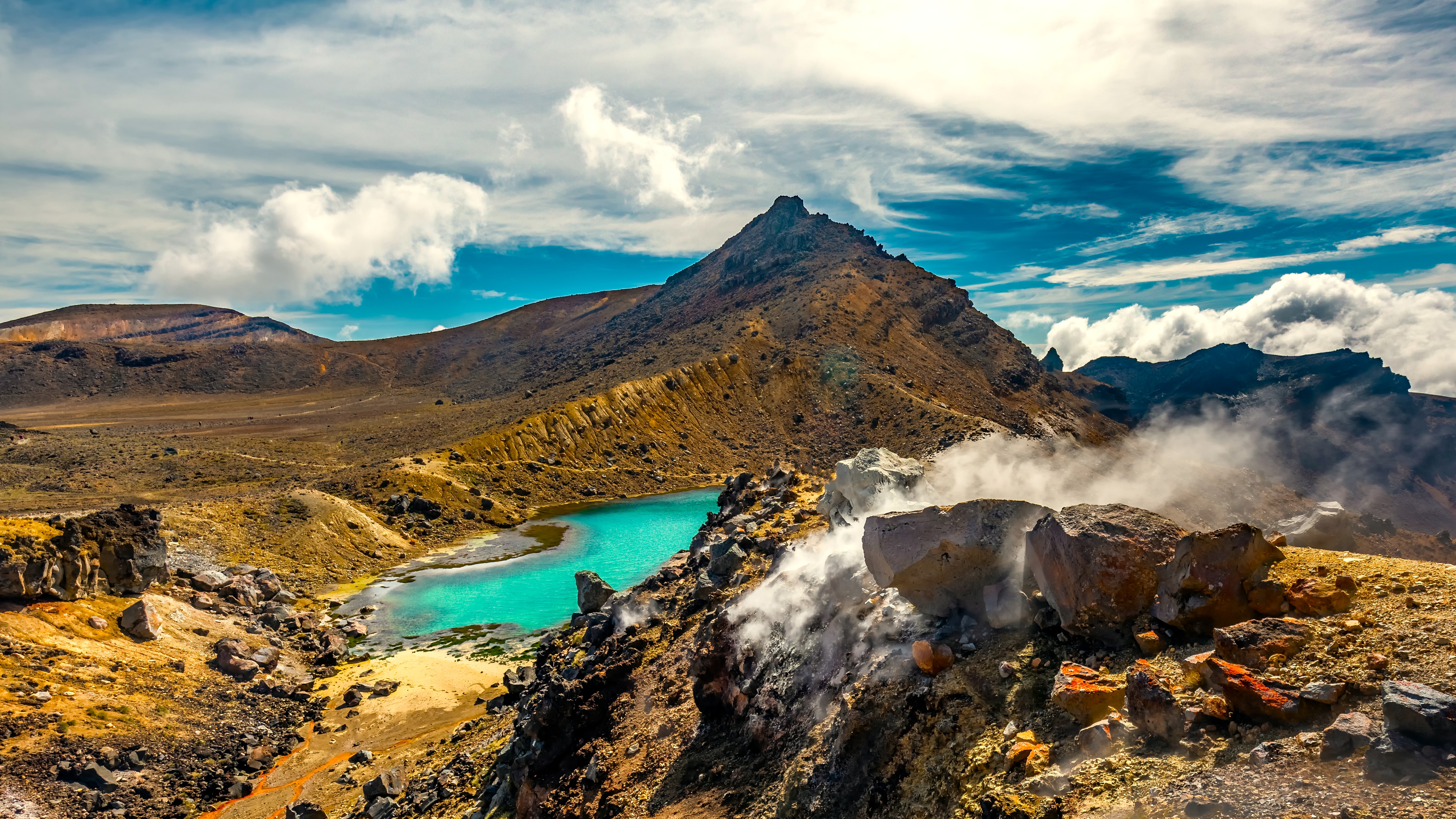
Spanning 19.4 km, this trail crosses red craters, emerald lakes and lava fields. It offers close-up views of Mount Ngauruhoe, as well as Mount Tongariro and Mount Ruapehu. Allow 6 to 8 hours of walking depending on your pace and weather conditions. It is the most accessible option for observing the volcano without climbing to its summit.
Ascending the summit
An ascent to 2,291 m adds approximately 3 km and 2 to 4 hours of effort to the Alpine Crossing. It is generally made from the South Crater, over slippery ash slopes in summer and snow-covered in winter. This is not a marked trail: the sacred nature of the summit and terrain instability make ascent strongly inadvisable. Park rangers encourage visitors to reconsider their plans.
Practical information
Trail access begins from the Mangatepopo car park, where parking is limited to 4 hours. Most trampers therefore use a shuttle service, which also allows them to complete the Alpine Crossing in a single direction.
The volcano is under constant surveillance: 4 seismographs, 2 GPS stations, gas analysis, 2 webcams and a microphone continuously monitor for any signs of renewed activity. The Department of Conservation regularly publishes alert levels.
Recommended equipment for tramping:
- Layered technical clothing, including a windproof and waterproof jacket
- Sturdy hiking boots suited to volcanic terrain
- At least 2 litres of water, energy-rich food, first aid kit
- Sunscreen, sunglasses, hat and gloves even in summer
Weather changes rapidly at this altitude: clear skies can turn within hours to snow, gusty winds or freezing rain, even during summer season.
When to visit
The best period for tramping around Mount Ngauruhoe runs from November to April, spanning southern summer and early autumn. Temperatures are milder, trails are snow-free and the risk of storms is reduced. Outside this window, the Alpine Crossing becomes an alpine route requiring crampons, ice axe and winter experience. Always check forecasts and volcanic alert levels before departure.
How to get there
Tongariro National Park is located in the centre of the North Island. From Auckland, allow approximately 4.5 hours' driving via State Highway 1. From Wellington, the journey takes about 5 hours. The villages of Whakapapa, National Park Village and Turangi serve as logistical bases with accommodation and shuttle services to trailheads. A rental car remains the most flexible option for combining Tongariro with other North Island stops.
Nearby attractions
Mount Ngauruhoe fits into a New Zealand itinerary rich in natural and cultural sites:
- Lake Taupo, the country's largest lake, 25 km to the north, ideal for a stop before or after the trek.
- The Museum of New Zealand Te Papa Tongarewa in Wellington, to deepen your understanding of the country's geological and Maori history.
- The Arthur's Pass National Park on the South Island, another major alpine region.
- The Banks Peninsula, a coastal contrast after the volcanic atmosphere.
- The Moeraki Boulders, a geological curiosity on the South Island.
FAQ
Frequently asked questions
Yes. Although it has not experienced a confirmed eruption since 4 July 1977, it remains classified as an active volcano. Fumaroles persist and seismic peaks were recorded in 2006 and 2015. The site is under continuous monitoring by the Department of Conservation.
Ascent is not formally prohibited, but it is strongly discouraged. The summit is tapu (sacred) to Maori people, the trail is no longer marked and ash slopes are unstable. Most visitors content themselves with the Tongariro Alpine Crossing, which skirts the volcano.
Geologically, Mount Ngauruhoe is the youngest eruptive vent of the Mount Tongariro volcanic complex, formed 2,500 to 7,000 years ago. Visually, it displays the characteristic conical silhouette, whereas Tongariro forms a more extensive and older massif.
Yes, it served as the model for Mount Doom in Peter Jackson's trilogy. Out of respect for Maori culture, however, its summit was not filmed in close-up: close-up shots were filmed from a distance and then retouched with digital effects.
The most favourable window spans November to April, during southern summer. Outside this period, the trail becomes an alpine route requiring specific equipment (crampons, ice axe) and experience.
Discover New Zealand with Nomadays
Mount Ngauruhoe and Tongariro National Park rank among the highlights of a North Island itinerary. To build a journey combining volcanoes, Maori cultures, fjords and alpine landscapes, explore our bespoke New Zealand travel packages.
Interested in this visit?
We can include it in your personalised itinerary.