Lake Taupō
Lake Taupō
New Zealand's largest lake, born from the eruption of the Oruanui supervolcano 26,500 years ago, Lake Taupō blends active geology, Māori culture and outdoor activities.
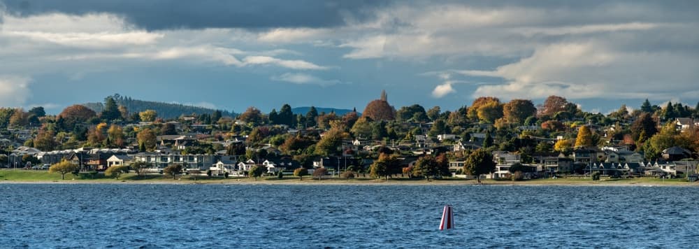
In the heart of New Zealand's North Island, Lake Taupō is the country's largest lake and occupies a volcanic caldera formed by one of the most violent eruptions of the past 70,000 years. With approximately 616 km², its waters feed the Waikato River, its shores give access to Tongariro National Park, and Ngāti Tūwharetoa culture permeates its landscapes. The town of Taupō, on the north-eastern shore, serves as a base for most visitors.
Why visit Lake Taupō
Three elements make this lake singular. Its geology first: it was born from the collapse of a supervolcano, and the magmatic system remains active beneath its 186 metres of depth. Its cultural dimension next: sacred to the Ngāti Tūwharetoa tribe, it bears the full name of Taupō-nui-a-Tia ("the great cape of Tia"), named after the chief who is said to have discovered it. Finally its role as a crossroads: Tongariro Alpine Crossing, Huka Falls, geothermal sites and water activities converge here, making it an almost essential stop between Auckland and Wellington.
Geological and human history
The caldera formed approximately 26,500 years ago during the eruption of the Oruanui supervolcano, which ejected over 1,000 km³ of ash and volcanic materials. The resulting depression gradually filled with water to form the present-day lake, with an area of approximately 616 km², a maximum depth of approximately 186 metres and a volume of approximately 59 km³.
A second major eruption, that of Hatepe in 232 AD, released approximately 100 km³ of materials in minutes. Its atmospheric effects were observed far and wide, as far as China and Rome according to chronicles of the period, though without direct deposits at such distances.
The first Europeans to reach the lake were missionary Thomas Samuel Grace (Church Missionary Society) in the early 1850s, then Austrian geologist Ferdinand von Hochstetter in 1859. The lake is fed by the Waitahanui, Tongariro and Tauranga Taupō rivers, and its only outlet is the Waikato River—the country's longest river. Eight hydroelectric dams operated by Mercury Energy dot its course and regulate the lake level.
What to see and do
The Māori Rock Carvings of Mine Bay
Carved between 1976 and 1980 by Matahi Whakataka-Brightwell, these monumental carvings approximately 10 metres high depict Ngatoro-i-rangi, the tohunga navigator said to have guided Ngāti Tūwharetoa ancestors. They are only accessible by boat, kayak or yacht from Taupō port. The crossing typically takes 1.5 to 2 hours return.
Huka Falls and the Waikato River
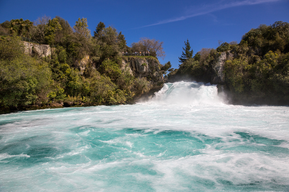
About ten minutes north of Taupō, the Waikato plunges through a rocky gorge where over 220,000 litres of water pass per second. Several walking trails line the falls; you can also approach them by jet boat. Further downstream, the Aratiatia Rapids awaken several times a day when the dam gates open.
Geothermal sites nearby
Craters of the Moon (wooden walkways over fumaroles), Orakei Korako (silica terraces and geysers, boat access), Wairakei Terraces (hot pools and cultural recreations) and Wai-O-Tapu further north form a chain of geothermal sites accessible in a half-day from Taupō. Beneath the lake's own waters, the Horomatangi reefs and several hot springs (Rotokawa, Turangi) harbour extremophile microorganisms.
Tongariro Alpine Crossing
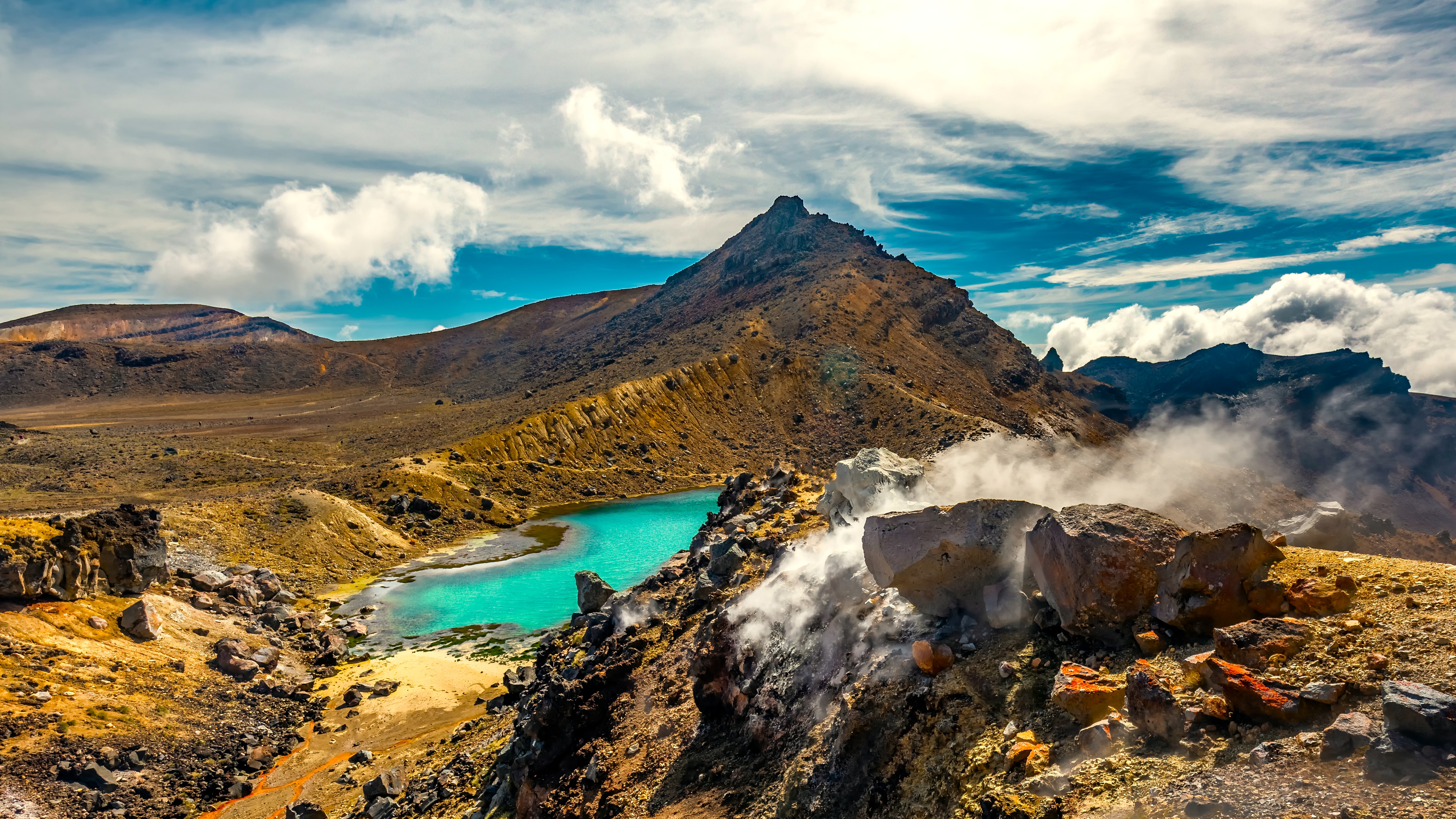
Considered one of the country's best one-day trails, this 19.4 km route crosses craters, emerald lakes and lava flows between the Tongariro and Ngauruhoe volcanoes. Departure is from Mangatepopo, south of Lake Taupō, with shuttle required. Allow 6 to 8 hours of hiking.
Water activities
The lake is suited to trout fishing (rainbow and brown, introduced in the late 19th century), kayaking, paddleboarding, sailing and swimming in sheltered bays. Classic cruises lead to the Mine Bay carvings. Thrill-seekers will find one of the country's best skydiving sites at Taupō, with landing facing the lake.
Sporting events
The Lake Taupō Cycle Challenge loops 160 km around the lake each November. The Ironman ANZCO takes place in Australasian spring. Some swimmers tackle the full lake crossing each year, approximately 40 km in open water.
When to go
The Australasian summer (December to February) offers the most stable conditions for swimming, water sports and the Tongariro Alpine Crossing, but it is also peak New Zealand tourist season. Autumn (March-April) remains mild and quieter. Winter (June-August) opens ski season on nearby Mount Ruapehu and offers clear days on the lake, with cool temperatures. Trout fishing is open year-round on the lake, with specific rules on tributary rivers.
Practical information
- Access to public lakeshores and trails is free.
- Cruises to the Māori Rock Carvings, jet boat rides on the Waikato, skydiving and Wairakei Terraces pools can be booked on-site or online; moderate to high prices depending on activity.
- The Tongariro Alpine Crossing shuttle should be reserved well in advance during peak season.
- The town of Taupō has an i-SITE (official visitor centre) that centralises bookings.
- Fishing licence required (Taupō Fishing Licence, distinct from the national Fish & Game licence).
How to get there
Taupō is on State Highway 1, approximately 3.5 hours' drive south of Auckland, 1 hour from Rotorua, and 4.5 hours north of Wellington. Long-distance coach services (InterCity) serve the town several times daily. A small regional airport (TUO) offers direct flights to Auckland. On-site, a car remains the most practical way to reach geothermal sites and hiking trailheads.
What to see in the region
Lake Taupō combines well with other highlights of the North Island and the country. To extend the geothermal and cultural experience, head towards Rotorua. For alpine hiking, Tongariro National Park is an hour to the south. If you then cross the Cook Strait, the Museum of New Zealand Te Papa Tongarewa in Wellington perfectly completes the cultural reading of your trip. On the South Island, the alpine landscapes of the Arthur's Pass National Park, the formations of Kura Tawhiti (Castle Hill), Banks Peninsula and the spherical boulders of Moeraki offer striking contrasts with the volcanic plateau.
FAQ
Frequently asked questions
Preparing your trip
Lake Taupō lends itself to rich combinations with the rest of the country. To plan a bespoke itinerary integrating the volcanic plateau, the southern fjords and Māori culture, check out our New Zealand travel ideas.
Interested in this visit?
We can include it in your personalised itinerary.